Under Construction 
Map at multiMap
The Ulster Scots or Scotch-Irish: Northern Ireland has a population of approximately 1.65 million, 900,000 Ulster-Scots Protestants and 750,000 Irish Catholics. | |
|
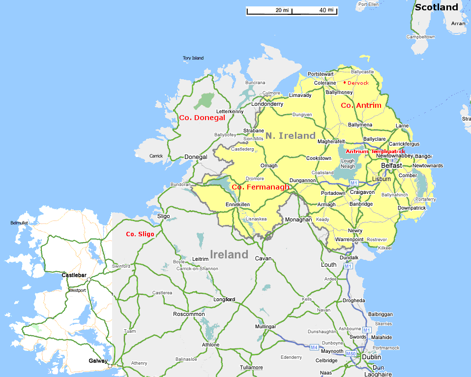
McBride's Majority with common DNA matches: Antrim, N. Ireland Templepatrick, N. Ireland Other: Dervock, N. Ireland County Sligo, Ireland Arran, Scotland
In the McBride Genealogy, Deanna Taylor says: "The Sept was located in County Donegal in the North West of the country. Some descendants may be of Scottish origin, the name having been brought into Ulster (N. Ireland) by Scottish settlers in the seventeenth century." |
Reihill Fermanagh Co., N. Ireland |
|
Links: The Ulster Scots Ireland maps at: www.chucklohr.com/ireland/ Province and County map at www.ireland-photo-library.co.uk/index.html Return to maps
| |

 Northern Ireland